


 detail, based on The Holy Land «Road Map of Israel-Palestine 1:150 000» printed by Freytag and Berndt (2016), The Corona “Traffic Light Map” of the National Emergency Portal (2020-21), The Black Flag Protest Map (2020-21), & The 'National Emergency Portal' (oref.org.il) during Operation Guardiand of the Walls against the Hamas in May 2021. Map, gauzes bandages, plaster, ink, thread and fabric, 340 x 170 cm, photo Michael Amar")

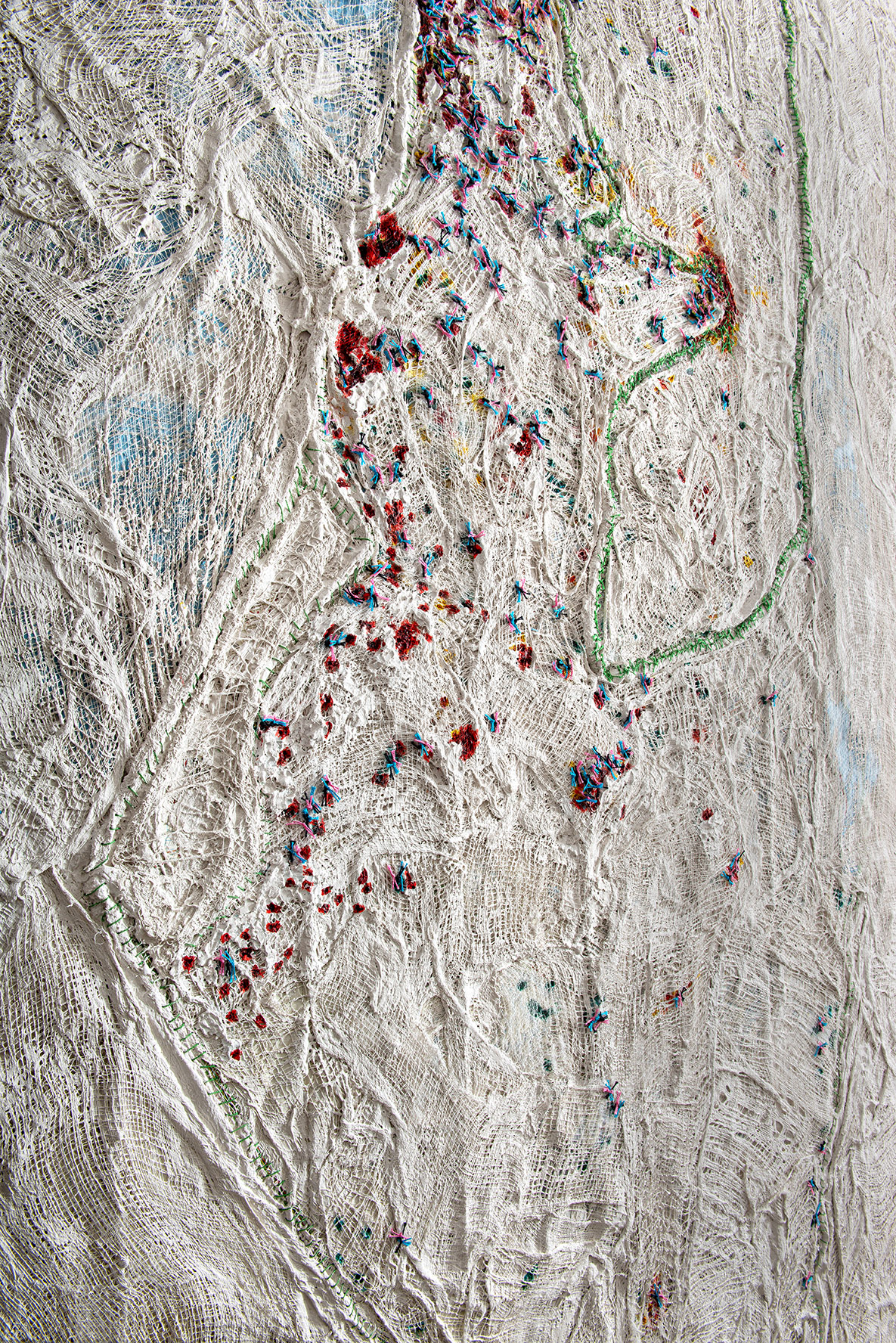
 detail, Gaza border sanguine red color for missile attacks on the South during Operation Guardian of the Walls in 2021, photo Michael Amar")
 detail, Judea Samaria, map, gauzes bandages, plaster, ink, thread and fabric
340 x 170 cm, photo Michael Amar")
 detail, Northern Border, photo Michael Amar")
 detail, Northern Border, photo Michael Amar")

, detail, photo: Udi Katzman")
, map of the Black Flag demonstration, detail, photo: Udi Katzman")
, map of the pandemic and map of the anti-government demonstrations flags, detail, photo: Udi Katzman")
, detail, photo: Udi Katzman")
, detail, photo: Udi Katzman")


Wounded Land 2020-2021, 2021
This large map of the country is composed of 4 maps.
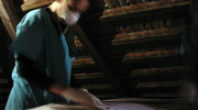
The first map is based on The Freytag and Berndt’s Holy Land «Road Map of Israel-Palestine 1:150 000» published in 2016 (https://eu.freytagberndt.cz/israel-palestine-1-150-000-road-map/). The map is dressed with layers of gauzes bandages dipped in industrial plaster and its international borders are stitched with green thread while the disputed area of Judea-Samaria/ The West Bank is sutured in a surgical way. Surgical knots secure the “embryo” to the mother map, its definite legal and political status pending its eventual birth.
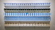
The second map refers to the Corona “Traffic Light Map” of the National Emergency Portal showing the colors of daily morbidity of COVID-19 in cities, towns and villages during the pandemic (https://www.oref.org.il/12409-17309-en/Pakar.aspx) . The colors alternated from red to orange and yellow eventually reaching the highly craved green color of de-confinement and with it, health and economic recovery. The numerous overlapping layers of plastered gauzes covering the shifting colors over time attests to a geology of morbidity.
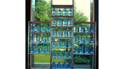
The black, pink and blue threads of the third map (https://hafgana.live/) refers to the colors of the flags held by protesters gathering on bridges, at highway junctions and in city squares all over the country. This tricolor map represents the thousands of citizens across the political spectrum who protested since March 2020 against PM Netanyahu over his corruption trial as well as against the economic hardship of the repeated confinements. On 23 March 2021, a year after the third legislative elections, the fourth legislative elections results showed a renewed political stalemate.
The last touch to the map in bright red ink was added just before the work was exhibited and it is based on the ‘National Emergency Portal’ (oref.org.il) of minute by minute information during “Operation Guardian of the Walls” of the rocket and missile attacks on Israel as well as riots in mixed cities took place during the Gaza conflict between Hamas and Israel in May 2021.
Wounded Map 2020-2021
Based on The Holy Land «Road Map of Israel-Palestine 1:150 000» printed by Freytag and Berndt (2016), The Corona “Traffic Light Map” of the National Emergency Portal (2020-21), The Black Flag Protest Map (2020-21) & The ‘National Emergency Portal’ (oref.org.il) during “Operation Guardian of the Walls” of the rocket and missile attacks on Israel & riots in mixed cities, May 2021.
Map, gauzes bandages, plaster, ink, thread and fabric
340 x 170 cm