


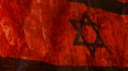


Wounded Land Maps (2009-2013), 2009
The ‘Wounded Land Maps’ are made of fragments of ‘West Bank Closures – Jerusalem’ Maps, dated July 2004. The maps show the Green Line, Israeli settlements and Palestinian villages, checkpoints and walls, barriers (planned and built) and road networks. The data is collected by OCHA (Humanitarian Information Centre) and the maps are the distributed by the UN office for the Coordination of Humanitarian Affairs in East Jerusalem. These maps, first used for a performance Surgical Operation held in 2004, became later a metaphorical reflection of Jerusalem complex reality regarding its disputed boundaries.
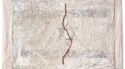
In August 2009, following my daughter’s accident, the sterile bandages that had covered her body, were used to cover fragments of Closure Maps. Cutting, erasing, sewing and swathing the maps in bandages allowed me to deconstruct the hierarchy of cartographic power inscribed within the original maps. Sewing the green letter X signifying ‘Barrier Gates’ as a decorative stitch around the maps, I created each time and in various locations a singular meditative moment.
My first public performance of sewing the maps took place in Jerusalem during the art event ‘Manofim’ at the Yellow Submarine Gallery in September 2009. Sewing took place in galleries, at cartographic conferences and in the Old City of Jerusalem where the green thread weave the religious quarters of the city together, ‘healing’ an invisible wound.